Marion
2025-02-12 18:56:52 UTC
Reply
Permalinkname in a certain large partly enclosed navigable coastline indentation.
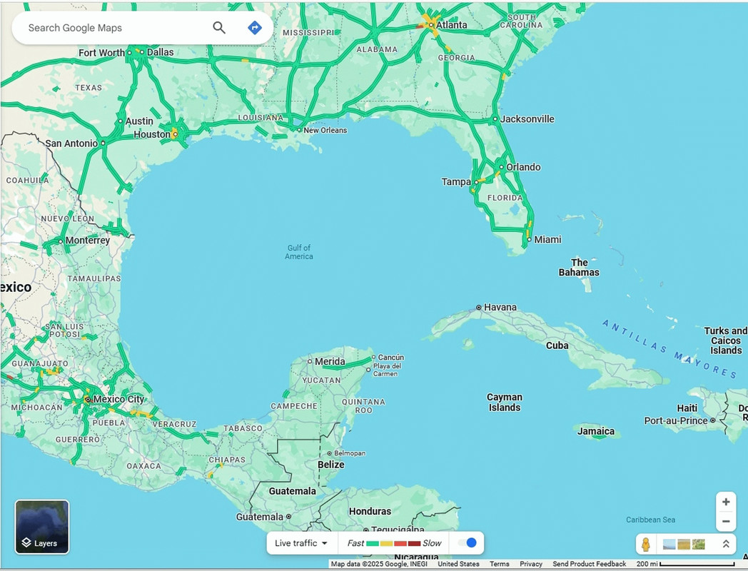
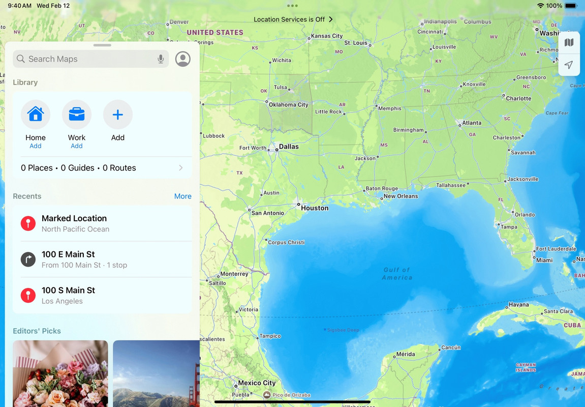
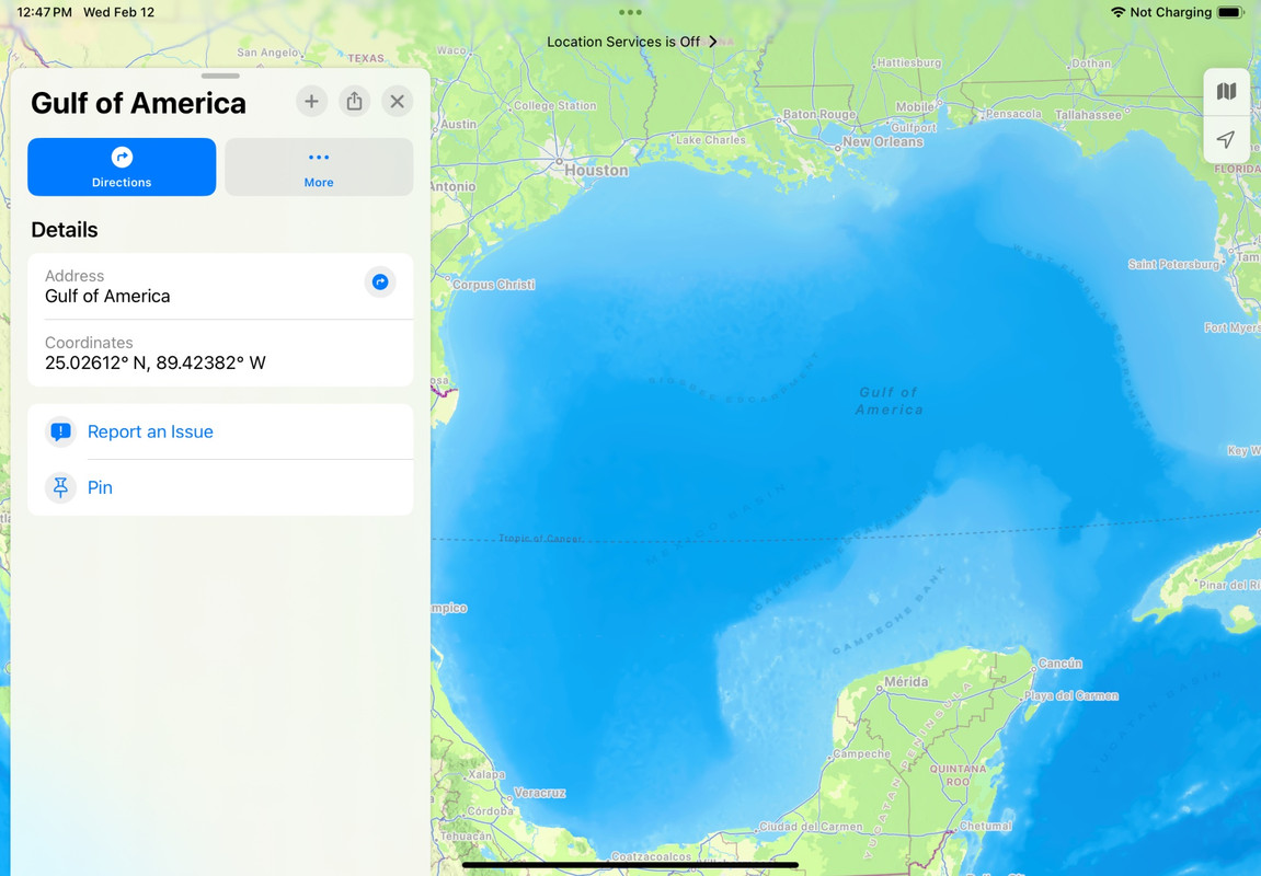
*gulf of america*
<https://www.novabbs.com/computers/article-flat.php?id=19070&group=misc.phone.mobile.iphone#19070>
Have all the Google & Apple maps around the world reflected that change?
All I can tell so far by looking it up after seeing it described for a few
days on the Apple newsgroups, is that the Geographic Names Information
System (GNIS) occurred sometime around late January 2025 following a
certain executive order and concomitant Department of Interior public
announcement.
My question here, to the world at large, is how much of the world's GNIS
systems are following suit? Is there any statement, for example, from
whatever mapping system the UK or EU use to formerly identify places?
Apparently the Ordnance Survey is the national mapping agency for Great
Britain proper, but the Permanent Committee on Geographical Names (PCGN) is
who advises the UK government on the correct form of geographical names
outside of the UK. Any status on that?
The EU is trickier to pin down, where the EU apparently relies on
individual member states for internal names, although I can find references
to the Infrastructure for Spatial Information in Europe (INSPIRE) which
seems to be who promotes standardization and harmonization of geographic
place names through individual initiatives.
Anyone across the pond have a status on what's changing or not for you?